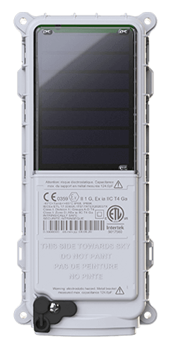
 SmartOne Solar
 SmartOne C
 STX3
STX3 STX3 Dev Kit
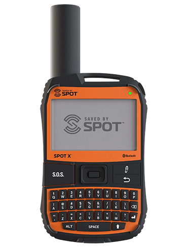 SPOT X
 SPOT Gen4
 SPOT Trace
Enhancing Wildfire Resource Accountability with SPOT Trace and Globalstar Satellite Technology
How Florian GPS Tracking and Globalstar improved safety and response coordination during the 2025 Dillon Fire
Background
In California’s 2025 wildfire season, the Dillon Fire erupted across steep, inaccessible terrain that pushed incident resources to their limits. Among them was retired firefighter John Aguirre, now a contractor working for California Interagency Incident Management Teams and the owner of Florian GPS Tracking, a company dedicated to improving firefighter safety and operational efficiency.
After decades on the line, John understood a simple truth: the safety of firefighters depends on knowing where people and equipment are at every moment. The Interagency model pulls resources from city fire departments, county agencies, Cal Fire, the US Forest Service, and third-party contractors. Engines, strike teams, hand crews, faller modules, bulldozers, masticators, graders, water tenders, fuel tenders, ATVs, and paramedic units all converge often from urban environments in response. But in urban environments, cellular is more reliable and available than when fighting wildfires in far-flung areas.
Once deep in the forest, those GPS cellular trackers failed. And when lives depended on speed, failure wasn’t an option.
Seeing firsthand how difficult it was to maintain real-time situational awareness, John set out to modernize wildfire resource tracking and accountability.
Challenge
Before Aguirre’s intervention, the resource check-in and tracking process at major incidents was almost entirely manual. When an engine, dozer, or crew arrived on scene, personnel recorded the asset number on a time card and placed it into a physical time-card rack. Some agencies arrived with GPS units, but the majority relied on cellular-based systems despite the fact that forest wildfires typically occur in areas with little to no terrestrial coverage.
This created several critical challenges:
1. Safety Risks from Poor Visibility
Divisions can span thousands of acres. Firefighters might reference landmarks, but shifting smoke, rapid fire behavior, and rugged terrain often made the precise location unclear. When a firefighter was injured or risked being overrun by the fire, precious minutes were lost attempting to identify where they actually were.
2. Mobility Constraints
Trackers that required charging could be forgotten or die mid-shift. Devices that required a vehicle power source couldn’t be used by hand crews, medics, chainsaw teams, or other personnel who spent their entire shift on foot.
3. Operational Efficiency
Without accurate GPS data, logistics and operations leaders could not track and reassign resources in real time. This slowed rescue response, prolonged travel times, and increased operational costs.
4. Financial and Contracting Complexity
Incident management personnel must track private crews and contracted equipment precisely to validate hours and avoid unnecessary costs. The absence of accurate automated data made this difficult.
Aguirre needed a tool that was small, durable, satellite-enabled, and battery-powered, something every resource could carry, whether on a pack strap, inside an engine cab, or mounted to a bulldozer.
Solution
Aguirre chose the SPOT Trace, powered by Globalstar’s satellite network, as the core of his redesigned resource tracking program.
Why SPOT Trace Fit the Mission
Battery-Powered Reliability
The unit runs on replaceable batteries: no chargers to forget, no downtime. Firefighters could deploy it for days while staying completely off-grid.
Portable and Lightweight
Small enough to strap to a pack, belt, ATV, or any piece of equipment—ideal for hand crews, faller modules, medics, and Rapid Extraction Module Support (REMS) teams.
Satellite-Based Connectivity
With Globalstar satellites, tracking remained reliable far beyond the reach of cellular networks.
Waterproof and Rugged
Built for harsh conditions: heavy smoke, wet line, ash, and debris.
Web-Based SPOT My Globalstar Dashboard
This gave Aguirre a single map view with the ability to view the real-time locations of engines, crews, medics, ambulances, dozers, strike teams, REMS, and more. Aguirre was able to use the mapping system to geofence resources, map drop points, and route resources in real time.
A System Designed for the Realities of Firefighting
Aguirre’s process is designed to enable:
- Safety: Precise location tracking of incident resources, especially medics and ground ambulances.
- Accountability: Automatic time logging for contracted crews and equipment.
- Operational Efficiency: Ability to visualize the need to reassign and route resources instantly.
- Planning & Finance: Accurate records that protect incident budgets.
During the Dillon Fire, this system faced its first real test.
Results
Incident One: Firefighter Down
Mid-shift, a firefighter experienced a medical emergency while deployed on the fireground. Because Aguirre had pre-logged all drop points and integrated every medical resource tracker into SPOT My Globalstar, he could immediately pinpoint:
- The exact drop point where the firefighter was located
- The nearest ambulance
- The closest paramedic and EMT
- The closest REMS team
“I could feel the sigh of relief from people,” Aguirre recalled. Incident leaders instantly had real-time actionable coordinates and could see the responding units moving on the digital map.
The rescue response was rapid, organized, and precise.
Incident Two: Faster Medical Transport
A second medical emergency occurred later in the Dillon Fire. This time, the SPOT My Globalstar routing function became critical.
Aguirre quickly evaluated the available transport routes using the mapping software and identified the quickest path for responding medical resources. Using the mapping system to visualize the location of each resource, John was able to recommend the relocation of an ambulance to be closer to the firefighter in need. He immediately relayed new routing instructions to the incident management team.
“Without GPS tracking and the visible location of each unit, we wouldn't have known that,” Aguirre said. The patient was transported faster because real-time data guided the response.
Conclusion
During the 2025 Dillon Fire, SPOT Trace and Globalstar satellite connectivity proved their value not just as a tracking tool, but as a life-safety system. Aguirre’s integration of satellite GPS tracking transformed how the Interagency team monitored its people and equipment:
- Improved firefighter safety
- Faster medical response
- Better operational coordination
- Increased efficiency for logistics and finance
- Automated accountability for contracted crews
For John Aguirre, the results were clear: tracking incident resources with satellite-based GPS trackers enhanced wildfire response and increased safety. There was a need to bring incident situational awareness to a modern age and SPOT Trace filled the gap: simply, reliably, and in the moments when seconds mattered most.
Learn more about interagency tracking at https://floriangpstracking.com
Learn more about Globalstar at globalstar.com