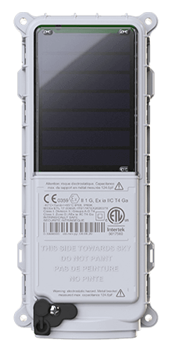
 SmartOne Solar
 SmartOne C
 STX3
STX3 SPOT X
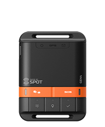 SPOT Gen4
 SPOT Trace
Tracer Release Experiment in the Gulf of St. Lawrence Buoyed by SPOT Satellite Technology
Advancements in satellite communications technology are fueling innovation in IoT and M2M applications, providing organizations with new abilities to monitor, track and gain data insights from assets – fixed, mobile and from any location. One such application is currently underway using Globalstar’s satellite technology for a ground breaking oceanographic research study in the Estuary and the Gulf of St. Lawrence in the Province of Quebec.
The Tracer Release Experiment (TReX) in the Gulf of St. Lawrence, jointly supported by the Quebec maritime network and the MEOPAR network, aims to develop marine dispersion observation and forecasting capabilities, in response to maritime incidents in coastal areas.
It also studies the impact of human activities and climate change on marine ecosystems. The project’s lead researcher, Dany Dumont, summarizes his work in simple terms, explaining “we are studying surface ocean currents trying to understand how things drift and disperse near the ocean surface”.
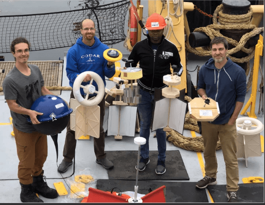
Pictured far right, Dany Dumont, Professor at the Institut des sciences de la mer de Rimouski (ISMER), Université du Quebec à Rimouski (UQAR), and researcher with the TReX project, shown holding one of the three kinds of drifters equipped with SPOT Trace.
The prediction of drift and dispersion is at the heart of search and rescue operations, environmental response and risk management. By collecting data on ocean drift patterns, a wide range of stakeholders, from governments to environmental groups, will have the ability to better manage risk, ensure the safety of coastal communities and prepare for the management of incidents involving a spill of contaminants.
The SPOT Trace devices are attached to various kinds of custom-built drifters made of wood and metal. SPOT offers the TReX team advanced tracking capabilities in their study of ocean currents. The team has created their own API integrated with the SPOT Mapping platform, which allows near real-time tracking of each drifter. Because SPOT Trace uses 100% satellite technology, it can communicate waypoints from some of the most remote locations.
“The TreX project started in 2014. We began collecting data by deploying SPOT Trace devices on floating drifters made of wooden plates and releasing them at key locations in the St. Lawrence,” explains Dumont. The SPOT Trace devices enable the team to create smart drifters, to gather data on the movement patterns, changes and trajectories which are tracked and studied at 5-minute intervals (see map below).
SPOT Trace is a small, waterproof GPS device that provides advanced tracking for business or recreational users. A text or email is generated when assets move at pre-set intervals. Users can also follow the movement via SPOT Mapping from any smartphone, computer or tablet.
For the TReX team, SPOT Trace satellite technology including an advanced mapping interface, provides the near-real time data and historical record of ocean drift that is at the core of their research.

Artículo por:
Globalstar
Globalstar