Enhancing First Responder Safety with Satellite Connectivity: A Powerful Proof of Concept
The Challenge
Locating First Responders Beyond Vehicle AVL
First responders operate in dynamic and often unpredictable environments. While Automated Vehicle Location (AVL) systems have become the industry standard for locating emergency response vehicles, personnel on foot are more challenging to locate once they leave their vehicles.
This gap in location awareness presents potentially critical safety risks, particularly in large-scale disasters, when cellular coverage can be unreliable or the networks become overloaded.
Understanding this challenge, the CAL FIRE Office of Wildfire Technology Research and Development (OWTRD) initiated a proof of concept in 2024 to explore solutions for dismounted firefighter location.
The department wanted to determine the feasibility of an easy-to-adopt hardware- and software-agnostic system that could provide real-time location data for first responders, enhancing situational awareness and improving emergency response operations.
The Solution
A Unified Satellite-Based Tracking System
To address the challenge, CAL FIRE OWTRD sought a solution to integrate multiple platforms, user interfaces, and handheld location devices into a streamlined, interoperable system. The proof of concept required overcoming barriers related to connectivity, hardware availability, software compatibility, and end-user adoption.
Key criteria for the solution included:
- Reliable connectivity independent of cellular networks: Ensuring personnel location in areas with no cellular service or during large-scale emergencies when cellular networks are overwhelmed.
- Readily available hardware: Leveraging satellite devices that are easily accessible via retail channels and that do not require smartphone applications or impact battery life.
- Privacy and security: Allowing users to disable or detach tracking as needed.
- Usability across multiple disciplines: Ensuring the solution was applicable beyond wildfire response, including urban search and rescue, structure fires, law enforcement, swift water rescue, forest operations, and environmental monitoring.
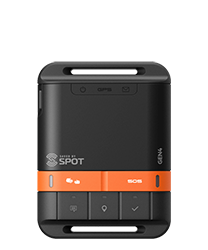
As part of this initiative, Globalstar’s SPOT X and SPOT Gen 4 satellite messengers were deployed, leveraging Globalstar’s Low Earth Orbit (LEO) satellite technology to provide reliable, independent location capabilities. Globalstar has a proven track record with its SPOT devices that offer resilient global communications and the company proudly reports its SPOT devices have been responsible for more than 10,000 emergency rescues.
The Result
Improved Situational Awareness and Safety
The proof of concept demonstrated that a satellite-based location system for dismounted firefighters is not only feasible but highly effective in enhancing emergency response operations. Key benefits included:
- Enhanced situation awareness: Providing personnel location capabilities improved tactical response, supported better resource allocation, and enabled a clearer frame of reference for radio communications.
- Increased safety: The solution can allow first responders to request additional resources and communicate their precise location during emergencies, ensuring faster response times and improved operational coordination. SPOT devices can be set to ping as frequently as every 2 ½ minutes to ensure location monitoring is granular.
- Greater adoption potential: By using hardware and platform-agnostic solutions, agencies can more easily integrate without custom developments.
While CAL FIRE OWTRD’s proof of concept was not a mandated deployment, it successfully demonstrated that real-time first responder location capabilities are both achievable and beneficial. The findings underscore the importance of satellite-based solutions for emergency response, particularly in situations where traditional communication networks fail.
“We saw a need and wanted to prove that it could be done,” said CAL FIRE OWTRD Deputy Chief Marcus Hernandez. “We successfully moved an idea into a reality with this proof of concept to show that satellite connectivity and technology have a powerful place in first response, situational awareness, and keeping our most important assets – people – protected.”
Globalstar’s SPOT X and SPOT Gen 4 devices, combined with its robust, redundant LEO satellite connectivity, are well aligned with the needs of disaster and emergency response agencies. This proof of concept from CAL FIRE OWTRD reinforces the vital role of satellite technology in improving first responder safety, enhancing situational awareness, and ensuring mission-critical communications in the most challenging environments.
Learn more about how Globalstar connectivity and satellite devices can support safety, situational awareness, and response.
About CAL FIRE Office of Wildfire Technology Research and Development
The Office of Wildfire Technology Research and Development serves as the central organizing hub for the state government’s identification of emerging wildfire technologies. The Office’s goal is to drive meaningful advancements and tap innovation from the public and private sectors. Subject to review by the Wildfire Technology Research and Development Review Advisory Board, the Office is focused on driving innovation and in constant search of the best and most effective technologies available in the ongoing battle against wildfire.
About Globalstar, Inc.
Globalstar empowers its customers to connect, transmit, and communicate smarter – easily, quickly, securely, and affordably – offering reliable satellite and terrestrial connectivity services as an international telecom infrastructure provider. The Company’s low Earth orbit ("LEO") satellite constellation ensures secure data transmission for connecting and protecting assets, transmitting critical operational data, and saving lives for consumers, businesses, and government agencies across the globe. Globalstar’s terrestrial spectrum, Band 53, and its 5G variant, n53, offer carriers, cable companies, and system integrators a versatile, fully licensed channel for private networks with a growing ecosystem to improve customer wireless connectivity, while Globalstar’s XCOM RAN product offers significant capacity gains in dense wireless deployments. In addition to SPOT GPS messengers, Globalstar offers next-generation internet of things ("IoT") hardware and software products for efficiently tracking and monitoring assets, processing smart data at the edge, and managing analytics with cloud-based telematics solutions to drive safety, productivity, and profitability. For more information, visit www.globalstar.com.
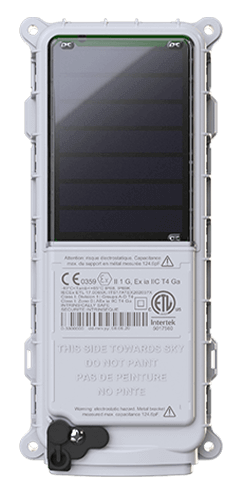
 SmartOne Solar
 SmartOne C
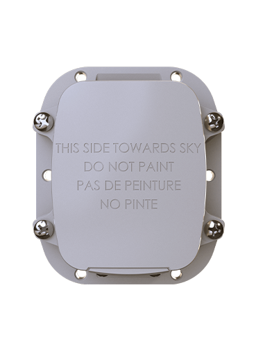
 STX3
STX3 SPOT X
 SPOT Gen4
 SPOT Trace
