 SmartOne Solar
 SmartOne C
 ST100
ST100 STX3
STX3 STX3 Dev Kit
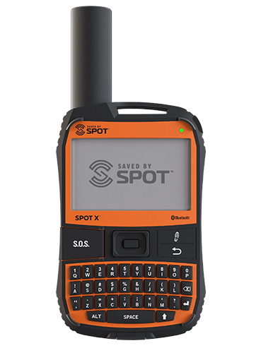 SPOT X
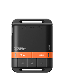 SPOT Gen4
 SPOT Trace
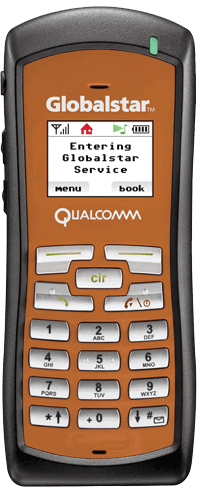
Why Asset Tracking & Reliable Connectivity Help Government Agencies Prepare for the Unexpected
Every government department, agency or bureau faces the same challenge. They bring limited resources to meet needs that sometimes know no limit. Taxpayers want their governments to be run like businesses: lean, efficient and with a sharp eye on the bottom line. But when bad things happen – from wildfires and disease outbreaks to travel disruptions and facility closures – government is expected to be fully funded, fully briefed and ready to help.
Globalstar operates a satellite network with a difference. It was engineered to provide smart data – just the information, location tracking and messaging you need at an affordable cost over most of the world.
The gap between resources and needs can never be filled, but it can be bridged. The key is improving your situational awareness. That term, coined by the military, means knowing what is going on at any given time in the area you are responsible for. To achieve situational awareness, you need to receive the right information at the right time and be able to interpret its meaning.
Knowing Where and When
For government entities, few pieces of information are more important than where and when. Knowing where people, vehicles and equipment are right now helps protect them from mishap or loss. It allows managers to understand the resources they have available and coordinate their actions. Add the ability to exchange messages with people in the field, and even resource-constrained organizations can move fast and effectively while knowing enough about the situation to keep other organizations and the public informed.
Situational awareness requires one more thing. Reliability. We have all come to depend on our mobile phones for location data and communications. But on rural roads, deep wilderness and disaster zones, cellular coverage becomes unreliable. That’s why organizations that are serious about situational awareness turn to satellite technology, which offers a single platform that covers the world from “cell towers in space.”
Tracking and Texting
Globalstar operates a satellite network with a difference. It was engineered to provide smart data – just the information, location tracking and messaging you need at an affordable cost over most of the world.
Where and When
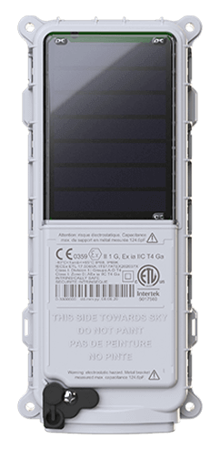
Asset trackers attached to vehicles and equipment can provide accurate GPS coordinates as often as every couple of minutes or as little as once per day, depending on your need. Ideally, they combine small size, easy mounting, and extreme ruggedness with low cost for hardware and service. Globalstar devices include options like the SmartOne Solar, certified Intrinsically Safe (ATEX + HERO), the SmartOne C, which can be line or battery powered and the SPOT Trace, a turn-key and affordable simplified tracking solution. Our satellite-powered satellite modems are designed to enable OEMs, developers, and VARs to accelerate production timelines.
What and Why
Situational awareness also requires dependable communication among field teams and headquarters. Remote workers can use sat phones, but they can be hard to use and voice service can be spotty in rugged terrain. Text messaging systems, with their small bursts of data, get through where voice can’t, and cost less, too. Globalstar provides two options. The SPOT X offers two-way messaging with its own built-in keyboard and Bluetooth capability, while the SPOT Gen4 provides one-way messaging for check-in and access to SOS for emergency assistance.
Satellite at Work for Government
Remote and Lone Workers
The US Forest Service uses SPOT Messengers for its Search, Emergency Notification Devices (SEND) program, which keep field workers connected and protected during search and rescue missions. Units in the field range from one-way SPOT Gen4 to the SPOT X.
Asset Tracking and Dispatch
State forestry agencies across the United States use SPOT Trace and SmartOne Solar devices to track firefighting vehicles, and SPOT Messengers to handle dispatch and routing. Knowing their exact locations lets fire managers make the most efficient use of every vehicle in the fleet, which provides a critical advantage in today’s increasingly active fire seasons.
Covering the Wilderness
Nunavut, Canada’s Arctic province is massive, covering more than 800,000 square miles, but sparsely populated with only 29,000 people. Resource extraction, hunting, fishing, whaling and tourism are vital to its economy. This led the Government of Nunavut to issue SPOT GEN 3 and SPOT X Messengers to its staff as well as hunters, boaters and visitors to keep them connected and protected.
Increasing your organization’s situational awareness sounds like a big and expensive job. It doesn’t have to be. Easy-to-use tools and services are available today that, requiring little to no training, can make your team in the office and in the field far more effective. So, when limited budget meets unlimited need, you will be good to go.

Article By:
Globalstar
Globalstar