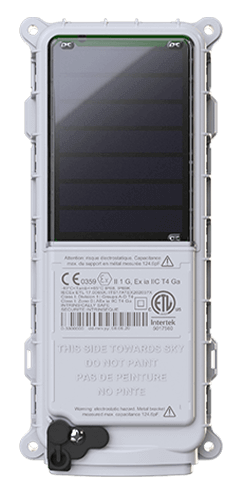
 SmartOne Solar
 SmartOne C
 STX3
STX3 STX3 Dev Kit
 SPOT X
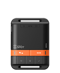 SPOT Gen4
 SPOT Trace
International Artic Buoy Program - Tracking Icebergs
About the Polar Science Center, Applied Physics Laboratory, University of Washington
The Polar Science Center conducts basic and applied research on the oceanography, climatology, meteorology, biology, and ecology of the ice-covered regions on Earth and elsewhere in our solar system. The scope of PSC research and fieldwork includes the Arctic and the Antarctic, as well as sea-ice, glaciers and continental ice sheets.
About Ignatius Rigor, Senior Principal Research Scientist
Ignatius Rigor is the Coordinator for the International Arctic Buoy Program (IABP, http://IABP.apl.uw.edu). His primary interests are in the use of data from the buoys to study air, sea, and ice interaction. His recent work has focused on analyzing surface air temperature observations in the Arctic, studying sea ices processes in the Russian marginal seas, and backtracking the source areas of pollutants found in sea ice. Ignatius holds an M.S. and Ph.D. in Atmospheric Science.
The Challenge
The participants of International Arctic Buoy Program (IABP) work together to maintain a network of drifting buoys in the Arctic Ocean to provide meteorological and oceanographic data for real-time operational requirements and research purposes including support to the World Climate Research Programme (WCRP) and the World Weather Watch (WWW). The data that would be collected by the team throughout their research would serve to inform the study surrounding Arctic climate and climate change, forecasting weather and ice conditions, validation of satellite information and more. In addition to the devices affixed to the buoys, the team required additional satellite powered tracking devices which could be dropped onto the icebergs. This network of buoys and tracking devices would provide an observational network via the real-time data received through satellite telemetry. While buoys can be deployed via vessel or pitched out of airplanes, the icebergs, due to their constant movement are often challenging and dangerous to track.
The Solution
The University needed a small satellite powered tracking solution they could deploy via drone onto the iceberg itself. The SPOT Trace, a compact one-way satellite tracking device was an ideal solution. The University deployed 44 SPOT Trace units, set at one-hour tracking intervals, linked with SPOT My Globalstar, a web based user-friendly tracking platform to access real-time visibility to their location.
In addition to the functionality of the SPOT Trace devices, the rolling nature of the icebergs often result in many of the trackers getting “kicked off” requiring a replenishment on a semi-regular basis. The price point of SPOT Trace enables the University to replace units in a cost-effective manner.
The Results
The location and insights provided from the SPOT Trace units provide the researchers with data, that when collected with additional information like sea level pressure, surface air temperature, ocean temperatures and other variables allow the University the ability to develop and deliver their analysis. Ultimately, the ability to accurately forecast the drift of icebergs, as well as ocean and sea ice conditions will serve to aid a variety of organizations to validate global weather and climate models.